With Missing Maps, we aim to improve response to crises by providing better maps and data for NGOs.
MapSwipe is an open-source mobile app that is making mapping around the world more coordinated and efficient. We believe that anyone, anywhere should be able to contribute to the Missing Maps project. We aim to proactively map places in the world that are most vulnerable to crisis before a crisis happens. From the comfort of a mobile phone, MapSwipe allows any individual to support humanitarian response in three simple steps:
Complete tasks by swiping through satellite imagery of areas that need mapping.

The data is used by the Missing Maps project to map vulnerable areas in more detail.

The maps help organisations coordinate humanitarian efforts and save lives.

Since its start in 2015, MapSwipe has scaled to 29,000 users mapping 600,000 km2 (larger than the area of Kenya). MapSwipe is volunteer-driven and community-led. Any organization or mapping community can request to use MapSwipe to help with their activities on the ground.
Within MapSwipe, users will soon be able to select to contribute towards three different project types. Each set of imagery is viewed by at least three different individuals to create a mechanism for internal validation of results. Learn more about each project type below and download the app to go through a complete tutorial before you begin swiping.
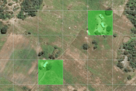
The original MapSwipe project, volunteers swipe through satellite images looking for features (ie: buildings, roadways, waterways, etc.) and tap once when they have located them.
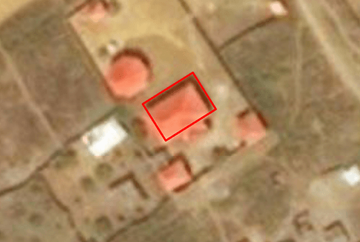
Volunteers view images where buildings have been traced in the Tasking Manager by remote mappers or through AI. They will indicate tiles where these traces are inaccurate or low-quality, targeting where improved mapping is needed.

This project type focuses on detecting changes in environments that may require updating map data. Volunteers look at a Before and After image, indicating if change is detected within the area.
MapSwipe is part of the Missing Maps Project with large support from these organisations.